
AEMET alerts
Weather warning in Spain: Orange-level alerts issued as heavy rain threatens many areas

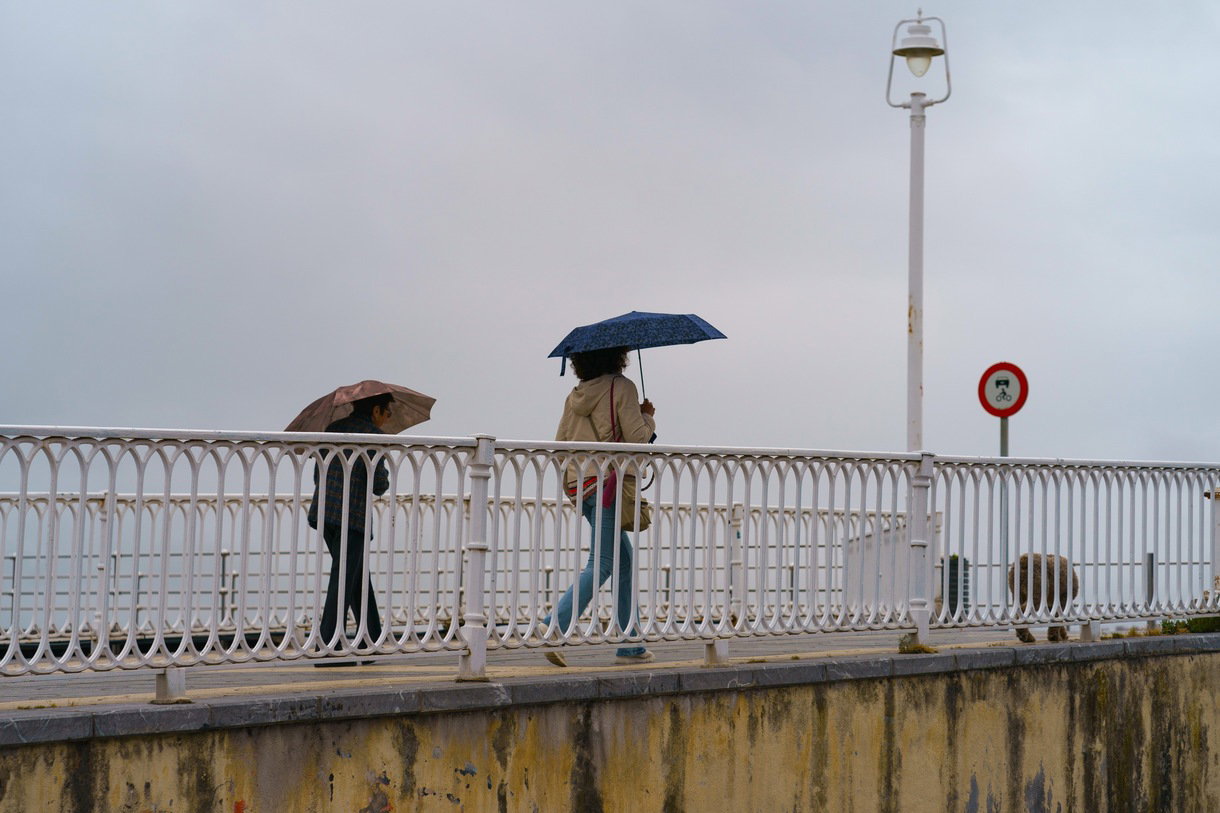
AEMET warns of flooding, thunderstorms and powerful winds as Storm Bruna brings a difficult start to the week.
Spain is facing another spell of potentially dangerous weather, with the State Meteorological Agency (AEMET) issuing orange and yellow warnings for heavy rain, thunderstorms and strong winds as Storm Bruna moves towards the mainland.
Residents in parts of western Andalucia, Extremadura and other areas are being warned to prepare for heavy downpours, while some parts of the country could receive more than 100 litres of rain per square metre in just 12 hours.
#BuenosDías
Domingo marcado por el cambio de tiempo.
En los próximos días, no olvides el paraguas ☔ y mantente siempre informado a través de los canales oficiales. https://t.co/x8OVNA0aSl
— EMA 112 (@E112Andalucia) November 8, 2026
Although the worst of the weather is expected further west at first, people living along the Costa del Sol, Costa Tropical, Costa Blanca and Costa Calida should keep checking local forecasts as the situation develops.
AEMET’s latest outlook suggests the unsettled conditions could affect large parts of the country until at least Wednesday, November 11, with rain potentially continuing into Thursday and Friday.
Orange weather alerts as rainfall totals climb
Orange warnings, indicating an important weather risk, have been issued for northern Caceres and southern Avila, where exceptionally heavy rainfall is expected overnight from Sunday, November 8, into Monday morning. AEMET forecasts up to 100 litres per square metre in 12 hours in these areas, with the possibility of accumulated rainfall reaching 200 litres over a 72-hour period.
08/11 00:06 AVISOS HOY Y MAÑANA | España: costeros, vientos, tormentas y lluvias. Nivel máximo de aviso: naranja.
Actualizaciones en https://t.co/BLdoSsO2Qv https://t.co/ytz2Ipg1Sy— AEMET (@AEMET_Esp) November 7, 2026
Even more warnings are being issued at yellow level across several other mainland regions. These include parts of Huelva, Sevilla, Badajoz and the Sierra de Grazalema in Cadiz Province. The warnings cover different periods, with some starting late on Sunday evening and others continuing throughout Monday.
Ronda, in Malaga Province, is also included in the yellow rain warnings for Monday, with the surrounding mountain area facing the possibility of substantial rainfall.
People living in these areas should take particular care around rivers, streams and normally dry riverbeds, where water levels can rise quickly following intense rainfall. AEMET’s official weather warning map provides the latest information about affected areas and alert levels.
Which parts of Andalucia are facing the worst conditions?
Western Andalucia is expected to take the brunt of the first major rainfall episode. Huelva Province is among the areas to watch, with yellow warnings covering the Aracena mountains, Andevalo and Condado districts and the coastal area. Parts of Sevilla Province, particularly the Sierra Norte, are also included.
Further east, the Grazalema mountain area in Cadiz Province and the Ronda district in Malaga Province are expected to receive heavy rainfall. For residents of the Axarquia, Malaga city, Nerja, Almunecar and the wider Costa Tropical, the current warning picture is less severe. These areas are not included in the orange rain alerts just yet, although showers and changing conditions cannot be ruled out as successive weather fronts cross the country.
The distinction is important: the highest rainfall totals are expected in the western and mountainous parts of the peninsula rather than across the entire Mediterranean coastline. Previous incidents have demonstrated how dangerous extreme rainfall can become in Malaga Province. A fatal rockfall during heavy rain near Ronda illustrated the risks that can accompany severe weather, particularly for motorists travelling through mountainous areas.
Heavy rain could continue until Wednesday
AEMET says the weather situation is being driven by a large area of low pressure west of the Iberian Peninsula, with Storm Bruna and its associated weather fronts bringing repeated spells of rain. Sunday, November 8, sees the heaviest rainfall concentrated across Galicia, western Castilla y Leon, Extremadura and western Andalucia. Huelva could receive more than 40 litres per square metre, while parts of the Gredos mountain range could record more than 60 litres.
Monday, November 9, is expected to be particularly difficult in several western regions. More than 60 litres could fall across parts of western and southern Galicia, western Spain and western Andalucia. The highest totals are forecast around the western Sistema Central and northern Extremadura, where accumulations could reach 120 to 150 litres per square metre.
Rain is expected to continue across much of the peninsula on Tuesday and Wednesday, although the distribution and intensity will vary considerably between regions.
AEMET expects conditions to start improving progressively from Thursday, November 12, although further heavy showers cannot be ruled out. Its special weather bulletin for Storm Bruna provides further details about the expected rainfall, wind and coastal conditions.
Strong winds and dangerous coastal conditions
Rain is not the only concern. Strong south-westerly winds are expected to accompany the weather system, particularly across exposed mountain areas and parts of the west.
Gusts could exceed 100km/h in some northern mountain locations, with speeds of 70 to 90km/h possible across elevated areas of western and central Spain, Andalucia and the Strait of Gibraltar.
Coastal conditions will also need watching. Waves could reach five to six metres along the western Galician coastline, while the sea off western Andalucia could see waves approaching four metres.
Anyone planning coastal walks or other seaside activities should pay attention to local warnings and avoid exposed promenades, breakwaters and rocky shorelines during rough conditions.
What should residents do during the weather warnings?
Civil Protection has warned that intense rainfall could cause localised flooding, rising river levels and dangerous conditions in low-lying areas.
Drivers are advised to reduce their speed, use main roads where possible and avoid attempting to cross flooded roads, even if the water appears relatively shallow. The Spanish Traffic Authority’s advice for driving during emergencies explains the dangers of flooded roads and sudden rises in water levels.
People should also avoid parking vehicles in flood-prone areas or beside normally dry streams and ravines. Sudden downpours can cause water levels to rise with very little warning.
Anyone living in a vulnerable location should follow instructions from their local council and emergency services. Spain’s Civil Protection service has published further advice as Storm Bruna approaches.
AEMET’s warning levels can change as new forecasts become available, so residents and visitors should check the official weather alert map before travelling.
For anyone in Spain, the message is to take the warnings seriously, particularly if travelling through western Andalucia or the mountainous interior over the next few days.


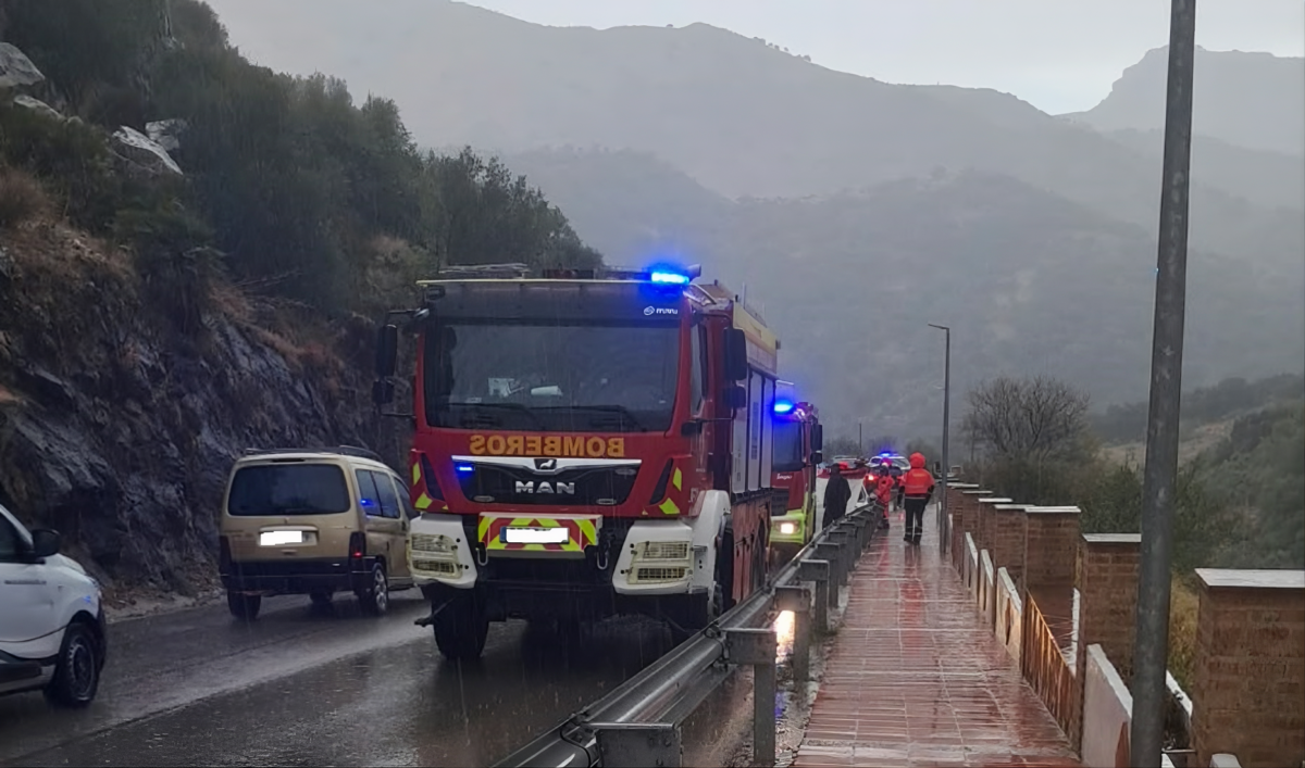
A 41-year-old man has died after a large rock fell onto his car during Monday’s torrential rain in Malaga province, prompting renewed warnings about the dangers of driving in extreme weather.
Three other occupants of the vehicle, two men aged 21 and a woman aged 19, were injured in the incident on the MA-8400 road between Benaojan and Estacion de Benaojan, near Ronda, on Monday, October 19. They were taken to hospital for treatment, according to Andalucia’s 112 emergency service.
The accident happened at around 4.11pm, when a rock broke away from a hillside and struck the vehicle. The Guardia Civil, provincial firefighters and medical teams were called to the scene.
Orange weather alerts mean serious danger
The tragedy occurred as parts of Malaga province were experiencing intense rain and thunderstorms. The Spanish weather agency AEMET had issued orange warnings for areas including Ronda, with further warnings covering the Sol and Guadalhorce districts as the storm developed.
An orange weather warning is not simply advice to take an umbrella. AEMET classifies it as a level of important danger, meaning weather conditions could cause serious harm, particularly to people in exposed locations.
Heavy rain can make roads treacherous within minutes. Water reduces tyre grip, increases stopping distances and can cause aquaplaning. On rural and mountain roads, intense downpours can also contribute to flash flooding, landslides and falling rocks or branches. Drivers should remember that even a familiar route can become dangerous when conditions change rapidly.
What should drivers do in extreme rain?
Spain’s Directorate-General for Traffic (DGT) advises motorists to reduce their speed, increase the distance from the vehicle in front and use dipped headlights so they can be seen more easily.
Its recommendations also include:
- Avoid unnecessary journeys: If an orange warning is in force and conditions are deteriorating, consider postponing non-essential travel.
- Never drive through floodwater: Water depth and the condition of the road beneath it can be difficult to judge.
- Watch for falling debris: Take particular care on roads beneath steep slopes, cliffs and exposed rock faces.
- Avoid sudden braking: Smooth driving helps reduce the risk of losing grip on wet surfaces.
- Stop safely if visibility becomes dangerous: Pull completely off the carriageway at a suitable place and wait for conditions to improve. Never stop in a live traffic lane.
Check the forecast before setting off
Drivers in Spain can check the latest warnings on the official AEMET website and road conditions through the DGT. Weather alerts can change during the day, so checking before departure is not always enough if a journey is lengthy.
The Benaojan accident is a stark reminder that dangerous weather is not confined to flooded streets and motorways. On exposed mountain roads, falling rocks can pose a potentially fatal risk. When an orange warning is in force, the safest journey may be the one that can wait.

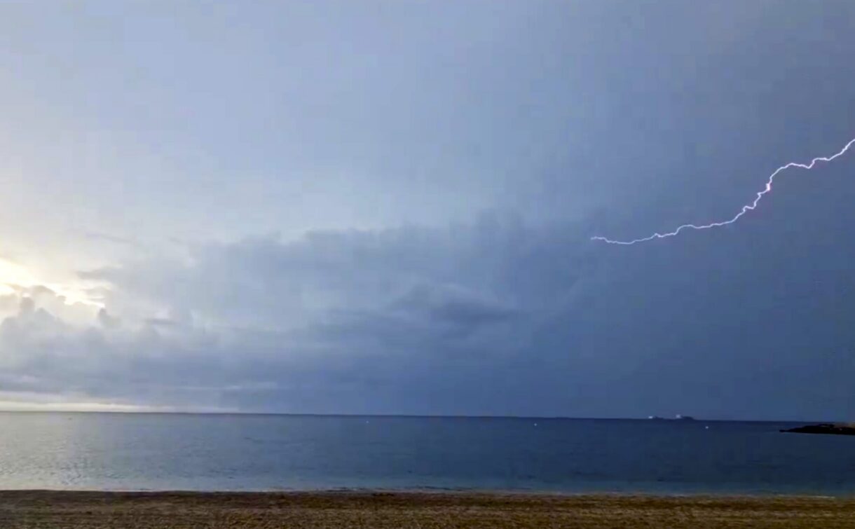
Residents and tourists along Spain’s Mediterranean coast are being warned to prepare for a weekend of heavy rain and thunderstorms, with parts of Murcia now facing an orange weather alert. The Cartagena and Mar Menor areas could see up to 50 litres of rain per square metre in just one hour on Saturday, October 17, while other coastal regions, including Alicante and parts of Andalucía, also face unsettled conditions.
State Meteorological Agency (AEMET) has issued a special weather warning, and the Ministry of the Interior has also warned residents and tourists to take the necessary measures to deal with the dangerous weather conditions.
The change comes after several days of unusually warm temperatures for mid-October. A developing weather system involving a DANA could bring intense and persistent rainfall to parts of eastern and southern Spain, although forecasters stress that the exact locations and intensity remain uncertain.
Almeria has been hit by torrential rain, with streets flooded in El Ejido and hail reported in Dalías, as Storm Adam brings intense downpours to southern Spain. The Poniente area recorded around 45 litres of rain per square metre at El Ejido by early Saturday afternoon, while the Junta de Andalucia activated its flood emergency plan. At 3.31pm, Civil Protection sent an Es-Alert emergency message to mobile phones after AEMET issued a red weather warning for Almeria city and the Poniente area. Residents were told to take extreme care, avoid unnecessary journeys and follow advice from emergency services.
The worst flooding reported so far has been in El Ejido, where powerful downpours left streets submerged and rubbish bins being swept along by the force of the water. Hail was also reported in Dalías, where rainfall totals had passed 20 litres per square metre. Further heavy rain remains possible as DANA Adam affects Spain’s Mediterranean coast over the weekend and into Monday, with the risk of sudden flooding in low-lying areas and normally dry ramblas. Residents should check the latest AEMET weather warnings, stay away from flooded roads and watercourses, and call 112 in an emergency.
Cartagena and Mar Menor face orange warning as emergency measures begin
Residents and visitors in Cartagena, Mazarrón, Fuente Álamo, Torre Pacheco and communities around the Mar Menor are being warned to prepare for potentially intense rainfall this weekend.
According to the Cartagena City Council, AEMET’s orange warning will come into effect at 12:00 on Saturday, October 17, and remain in place until 08:00 on Sunday, October 18.
Rainfall could reach 50 litres per square metre in just one hour, with accumulated precipitation of around 60 litres per square metre over twelve hours. Hail is also possible, with the most intense downpours expected between midday and 18:00 on Saturday.
In response, Cartagena City Council has activated its municipal services in the pre-emergency phase, preparing for possible flooding and disruption across vulnerable areas.
Residents have been advised to check roof drainage pipes, clear drains in garages and basements, and avoid parking in dry riverbeds or areas known to flood during heavy rainfall.
The authorities have also warned motorists not to attempt to cross flooded roads or ramblas, which can fill rapidly during intense downpours.
As an additional precaution, public parks are set to close, while large trees in public spaces will be cordoned off where necessary.
The Local Police have identified several roads particularly vulnerable to flooding, including the N-301a near the Rambla del Albujón and the RM-F35 towards La Aparecida.
Outdoor sporting events scheduled for the weekend have also been suspended, including the 10K Puerto de Cartagena race, which was expected to attract more than 1,000 participants.
The authorities are urging residents to avoid unnecessary journeys during the worst of the weather and to follow updated information from AEMET and local emergency services.
Spain weather warning: Which areas face the heaviest rain?
According to the official bulletin of the AEMET on October 15, the weather is expected to deteriorate from Saturday, with showers and thunderstorms developing in the interior, later spreading to the Mediterranean and the Balearic Islands.
Sunday, October 18, could bring some of the most difficult conditions, especially in coastal and near-coastal areas, where the rain may become both intense and persistent.
The forecasts identify several areas of concern, including eastern Catalonia, the Alicante coastline, parts of Andalucía and the Balearic Islands.
Ibiza and Formentera are among the places that will face particularly threatening conditions. An orange alert has been issued for the weekend. Parts of Barcelona and Girona are also under yellow alert, with the rainfall expected to reach 30 litres per square metre in one hour.
In the Valencian Community, the latest forecasts have also prompted orange warnings for parts of southern Valencia province and northern Alicante province, where particularly heavy rainfall could develop on Sunday.
AEMET has warned that some areas could receive between 150 and 250 litres of rain per square metre during the wider episode, potentially within just a few hours. However, forecasters stress that considerable uncertainty remains over exactly where the heaviest rainfall will fall.
The unsettled weather is linked to changes in atmospheric circulation over Europe. High pressure towards the British Isles and the North Sea is allowing colder air to move southwards, while an upper-level trough could develop into a DANA, the Spanish term for an isolated depression at high altitude.
This weather pattern can become particularly disruptive when colder air higher in the atmosphere interacts with warm, moisture-laden air from the Mediterranean.
Some meteorologists have described the possible system as a retrograde DANA, meaning it could move from east to west rather than following the more usual west-to-east direction.
Temperatures are also expected to fall from Saturday, with cooler conditions spreading more widely on Sunday.
In Valencia, daytime highs could fall from around 26°C on Saturday to 20°C on Sunday, while Barcelona could see temperatures drop from approximately 24°C to 20°C.
For residents and holidaymakers who have enjoyed the recent warm weather, the weekend is set to feel considerably more autumnal.
Spain’s Civil Protection authorities urge caution ahead of weekend storms
Spain’s Directorate-General for Civil Protection and Emergencies has also issued a warning following the latest forecasts.
In an official statement published on October 14, the Ministry of the Interior warned of the risk of intense rains in the Balearic Islands and Mediterranean coastal areas.
Authorities insisted that uncertainty over the weather system made it especially important to follow the latest forecasts and official warnings.
Residents in flood-prone regions are advised to take additional precautions, especially when travelling near rivers, ravines, and normally dry watercourses which may become inundated during heavy rainfall.
Motorists should avoid flooded roads, even if the water appears to be shallow, as its depth and force are not easy to judge.
People planning to go outside, to go to the coast or on a weekend trip are also recommended to check the weather conditions in advance.
In the Valencian Community, the emergency services have already warned local authorities to take all preventive measures in view of the expected rainfall. It is said that several events held in the Gandia area have been postponed as a precaution.
Although Saturday is expected to be the first day of the unsettled weather, Sunday and Monday may bring heavy rain to parts of the Mediterranean coast and the Balearic Islands.
Forecasts remain subject to change, and the areas experiencing the heaviest rainfall may shift as the weather system develops. Residents and visitors are advised to check the latest warnings on AEMET‘s official website and follow instructions from local emergency services.
Barcelona airport halts departures as baby’s medical emergency forces plane to land
Spain’s €17bn electricity grid overhaul aims to unblock housing, factories and major investment
Calpe welcomes acclaimed Italian pianist for special autumn music festival recital


-
DGT3 weeks ago
Viral video in Spain sparks fury over drivers who ‘have no idea how to drive’
-
Automated supermarket4 weeks ago
Spain’s 24-hour shop with no tills expands to Barcelona Airport
-
News4 weeks ago
Hundreds evacuated as huge fire erupts on Spain high-speed train route
-
Keeping cats and dogs outside3 weeks ago
Spain’s pet owners face fines of up to €200,000 for animal welfare offences
-
Council tax (IBI)3 weeks ago
Barcelona plans 150% property tax increase on tourist flats ahead of 2028 ban
-
Age Concern Marbella - San Pedro2 weeks ago
Halloween lunch sells out as 51 join Marbella get-together
-
airports3 weeks ago
Travelling between Spain and Italy? The extra border checks could soon end
-
Axarquia4 weeks ago
Torrox Oktoberfest gets a 1,500sqm beer tent for four-day festival