
aemet
Spain’s wildfire danger hotspots revealed in latest AEMET fire risk map

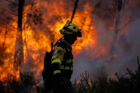
several serious wildfires have already broken out across Spain this summer. Photo credit: Cavan-Images/shutterstock
Nobody wants to think their afternoon walk, Barbecue or even a discarded cigarette could be the spark that starts Spain’s next major wildfire. But with the country already battling devastating blazes this summer, it’s worth knowing whether your area is now among those facing the highest risk.
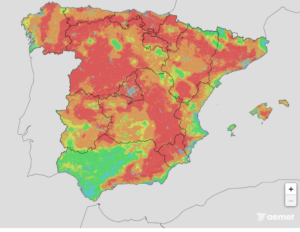
Spain’s State Meteorological Agency (AEMET) has identified several parts of the country as facing a high, very high or extreme risk of forest fires, with the danger changing daily depending on temperatures, humidity, wind and how dry the vegetation has become. For anyone planning a countryside walk, a weekend getaway, a camping trip or simply travelling through rural areas, the latest wildfire risk map is becoming just as important as checking the weather forecast.
Why the fire risk is climbing
Hot weather alone does not start wildfires, but it creates the perfect conditions for them to spread. After weeks of high temperatures and little rainfall in many parts of Spain, grassland, woodland and scrub have become increasingly dry. Add strong winds into the mix and even a small spark can quickly develop into a fast-moving blaze.
AEMET updates its forest fire danger map every day using weather forecasts together with information on vegetation, soil moisture and land conditions. The map identifies areas ranging from very low risk through to extreme danger, giving people an idea of where fires are most likely to start and spread. While the map is aimed at helping emergency services prepare, it also gives residents and visitors a chance to understand the level of risk where they are.
Recent fires show how quickly situations can change
The warnings come after several serious wildfires have already broken out across Spain this summer. In recent days, fires have forced road closures, disrupted train services and led to evacuations as firefighters battled to stop the flames reaching homes and communities.
Some blazes have spread across thousands of hectares in a matter of hours, fuelled by dry vegetation, difficult terrain and changing winds. For many people, these fires are a reminder that conditions can change rapidly. A quiet afternoon in the countryside can quickly turn into an emergency if a fire takes hold.
Everyday mistakes can have devastating consequences
During periods of high or extreme fire risk, authorities regularly remind people that many wildfires are caused by human activity. Throwing a cigarette from a car window, lighting a barbecue in an unsuitable location, using machinery that creates sparks or leaving glass bottles in dry vegetation can all increase the risk.
Even parking a vehicle on long, dry grass can create enough heat underneath the car to start a fire in the right conditions. Most people would never deliberately start a wildfire, but small mistakes during hot weather can have devastating consequences.
Check before you travel
If you’re planning to spend time outdoors, it’s worth checking AEMET’s latest wildfire danger map before setting off. The level of risk changes from day to day, meaning an area that was considered safe earlier in the week may face a much higher danger after temperatures rise or winds strengthen.
Knowing the conditions can also help people avoid activities that may increase the risk, particularly in wooded or rural areas. It is also worth paying attention to any local restrictions that may be introduced, including bans on lighting fires or limits on access to certain natural areas when the danger becomes particularly high.
A map that could make a real difference
Wildfires are becoming an increasingly familiar part of Spanish summers, and firefighters face a race against time every time the alarm is raised. While emergency crews continue preparing for another challenging season, there is something the public can do as well.
Checking the wildfire danger map before heading outdoors takes only a few moments, but it could help prevent the next major blaze. With several parts of Spain already classed as facing a high, very high or extreme risk of forest fires, knowing the conditions in your area is no longer just useful information. This summer, it could make all the difference.







aemet
Wildfires Have Already Consumed 50 Square Kilometres In Spain This Summer – Equal To 35% Of The Entire EU Total

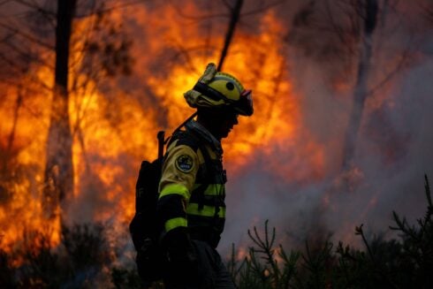
 MORE than a third of all land destroyed by wildfires across the EU this year has been in Spain, new data reveals – the highest share of any country in
 SPAIN is bracing for another punishing heatwave this weekend, with temperatures set to soar above 40C across parts of the country. State weather agency Aemet issued a flurry of orange

Newey admits Aston Martin neglected Alonso as nightmare season continues

Fire That Gutted Malaga’s Two-Star Hotel Ibis Finally Declared Over – 47 Days After Flames First Broke Out

Spain’s Magical Beaches Where You Might Catch A Glimpse Of Glowing Bioluminescence – From Galicia To La Linea
Alhaurin el Grande and Coin launch historic 1.5 million kilo season for premium tomato

Los Aficionados Al Ciclismo En Barcelona: “Que Venga El Tour De Francia Es Como Ir Al Mundial De Fútbol”

When is the next F1 race? British Grand Prix schedule and details for 2026


-
Alhaurin El Grande1 week ago
Alhaurin el Grande and Coin launch historic 1.5 million kilo season for premium tomato
-
 Antoni Gaudi1 week ago
Los Aficionados Al Ciclismo En Barcelona: “Que Venga El Tour De Francia Es Como Ir Al Mundial De Fútbol”
-
 Uncategorized2 weeks ago
When is the next F1 race? British Grand Prix schedule and details for 2026
-
Calahonda2 weeks ago
Lorry snags power cable on A-7 in Mijas, creating danger for drivers and residents
-
 Business & Finance1 week ago
Cheap Flights And Mass Tourism Are Adding €3,800 To The Cost Of The Average Spanish Home, New Report Warns
-
Latest1 week ago
Conservatives And Far Right To Govern Spain’s Andalusia Region
-
 Aleksandar Pavlovic2 weeks ago
Paraguay Elimina A La Apagada Alemania En Los Penaltis Para Firmar La Primera Gran Hazaña En Las Eliminatorias Del Mundial
-

 Donald Trump2 weeks ago
US Supreme Court Is Set To Rule On Cases That Will Define The Limits Of Presidential Power