aemet
Storms dominate northern Spain, but what about the Mediterranean?
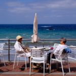
This week Malaga province welcomes warmer air as terral winds push temperatures above 25 degrees on Tuesday. Terral is when the warm air from inland Spain blows towards the coast, usually bringing dry air in and raising the temperature. Two local towns will rank among the warmest spots across the whole of Spain during this period. Records show 25.3 degrees in the city centre of Malaga, while Manilva is set to reach 25 degrees. Conditions will certainly feel spring-like after recent cloudy spells and scattered showers.
Warmth dominates through until Wednesday in much of Andalucia. Residents can enjoy pleasant daytime highs before the change arrives. Winds from the south-southeast are due to introduce clouds from Wednesday afternoon. Maximum temperatures will drop to around 20 degrees by Thursday. Clouds increase and bring a chance of showers later in the week.
Murcia faces yellow warning for heavy rain and storms
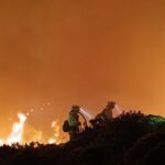
Storm activity affects parts of Murcia Monday night, with a yellow alert active until late afternoon. The Altiplano area will see possible rainfall up to 15 litres per square metre in an hour. Thunderstorms carry a 40 to 70 per cent probability. Weather reporters say that more intense bursts remain possible despite the alert level.
Skies feature cloudy intervals across the region during Tuesday morning with occasional light rain. Coastal areas clear somewhat in the afternoon, while inland zones develop convective clouds that may provoke showers and storms. Temperatures stay mostly stable on the coast but rise slightly inland. Forecasts point to highs between 22 and 26 degrees depending on the exact location. Light showers are predicted for Wednesday and patchy clouds for Tuesday, making the skies much more pleasing. Winds blow light from the west or southwest with moderate spells near the shore.
Costa Blanca Deals with showers on Monday before drier days
After some stormy weather at the start of the week, Alicante and the surrounding Costa Blanca should remain altogether much more pleasant throughout the week with patchy clouds and temperatures between 12 degrees at night and even up to 25° in areas in the day. There might be some light rain chances early Tuesday, but it will then dry up. Meanwhile, feel sorry for those more to the north in Valencia who have an unsettled week ahead with storms predicted.
Mallorca keeps unsettled pattern with occasional heavy bursts
A low-pressure trough system continues to influence Mallorca throughout the week. Rain chances stay present through at least Saturday. Tuesday features cloudy intervals and occasional showers, some locally heavy with thunder in the northeast. Morning mist appears in places. Daytime highs sit between 21 and 24 degrees.
Wednesday will see mostly light cloud with daytime heating possibly causing isolated showers. Similar conditions return on Thursday with light cloud cover, potential brief showers, and morning mist or fog patches. Temperatures will hold steady or dip slightly. Winds remain generally light from varying directions with coastal breezes.
Visitors and residents should prepare for variable weather
It’s spring in Spain, and visitors to these regions will benefit from checking updates regularly, as the weather at this time of year always proves changeable. Andalucia offers initial warmth ideal for beach visits before cooler air and rain arrive midweek. Murcia requires caution for localised heavy downpours early on. Costa Blanca mixes sunny intervals with shower risks, while Mallorca maintains higher shower probabilities overall.
Light winds and comfortable temperatures characterise much of the period despite the unsettled elements. Holidaymakers packing layers and waterproof items stay prepared for transitions between brighter and wetter phases.


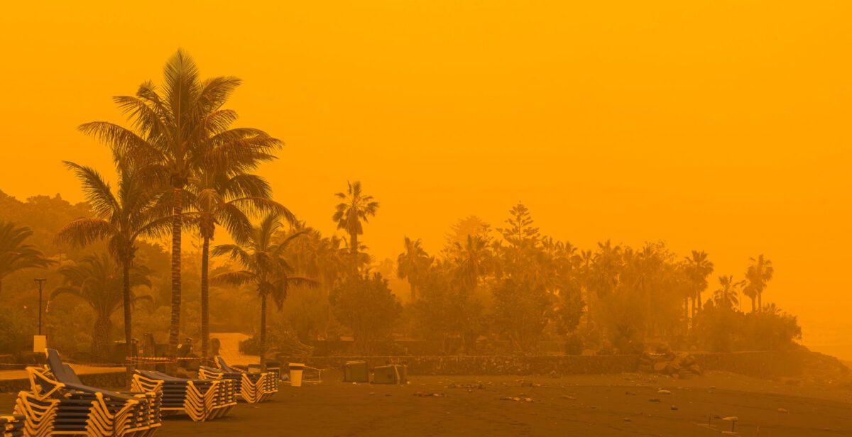
Forecasters from Spain’s state meteorological agency AEMET warns of a subtropical air mass advancing on southern mainland Spain today with associated calima and unusually high temperatures for the month of April.
Clouds of calima are moving northward from recent dominance over the Canary Islands to influence sectors of the peninsula by Monday afternoon, April 20, according to the latest forecasts. Warm air will result in conditions much more typical of June rather than April across affected southern zones of mainland Spain.
Daytime maximum temperatures will sit five to ten degrees above normal values in many locations for this time of year, according to the latest AEMET updates released.
Saharan calima moves across southern mainland Spain
A vast calima dust cloud is continuing its approach from western and southern paths, bringing dust in suspension that will become noticeable to observers in southern regions. Intervals of high clouds will accompany the hazy conditions in southern coastal and inland spots as dust levels rise.
Southern Spain faces record April heat levels
Cities including Seville, Cordoba, Jaen and Badajoz face readings above 30 degrees Celsius in the days ahead, with Seville possibly reaching 36 degrees on Tuesday. Tuesday then will bring extra calima flows from southern directions across the peninsula and the Balearic Islands while temperatures are likely to climb further in southern areas.
High temperatures are expected to hold steady or climb slightly in southern regions throughout the week, with models showing that the hot weather will not relent.
Calima and heat outlook for the week in southern Spain
Residents may witness some muddy rain episodes where showers interact with dust particles later in the week in some southern regions.
AEMET spokesperson Ruben del Campo confirms the very warm environment for this time of year with maxima more suited to early summer. Dust suspension becomes noticeable in the atmosphere as the subtropical mass settles over southern territories.
En los próximos días una masa de aire de origen subtropical llegará a España.
Lo notaremos por el polvo en suspensión que traerá consigo. Y además👉
➡️ Temperaturas muy por encima de lo normal.
➡️ Cierta inestabilidad: formación de tormentas, localmente fuertes y con granizo. pic.twitter.com/Elfgu24bnA
— AEMET (@AEMET_Esp) April 19, 2026
Official advice for heavy Saharan dust episodes
- Limit time spent outside, especially during peak dust hours.
- Keep doors and windows tightly closed to prevent dust from entering homes or cars.
Protect respiratory health
- Avoid any strenuous physical activity such as running or exercise in open air.
- People with asthma, COPD (Chronic Obstructive Pulmonary Disease), heart conditions, allergies or other chronic illnesses should follow their usual medication strictly and remain extra cautious.
Care for eyes and skin
- Wear sunglasses or protective glasses to shield eyes from irritation and possible gritty sensations.
- Apply moisturiser to skin and consider covering exposed areas with clothing or a hat when outside.
- Rinse eyes with saline solution or artificial tears if they feel irritated upon returning indoors.
Special advice for vulnerable groups
Children, older adults, pregnant women, smokers and those who work outdoors face higher risks. These groups should minimise all outdoor exposure and monitor symptoms closely. If breathing difficulties, persistent cough, chest discomfort or worsening of existing conditions occur, seek medical help promptly or call 112 in emergencies.
Stable patterns will dominate in southern territories with the main focus on heat and haze for everyone in southern and eastern Spain.


E
Hearts of gold: New life-saving defibrillators installed across the Costa del Sol
UK travellers, don’t get caught out – the Spanish airport rules and 100ml confusion
Brussels warns Spain that migrants regularised under controversial scheme will be deported back to Spain if they try to move to other EU countries
Murcia unveils monument marking 175th anniversary of Burial of the Sardine
Easter on the Costa del Sol: a time of renewal


-
eu response to spain migration policy4 weeks ago
Brussels warns Spain that migrants regularised under controversial scheme will be deported back to Spain if they try to move to other EU countries
-
Costa Calida4 weeks ago
Murcia unveils monument marking 175th anniversary of Burial of the Sardine
-
Costa del Sol4 weeks ago
Easter on the Costa del Sol: a time of renewal
-

 Caso Koldo3 weeks ago
Dinero En Efectivo Guardado En Casa Y La Devolución De Los Gastos Del PSOE: La Expareja De Koldo Protagoniza La Cuarta Jornada Por El ‘caso Mascarillas’
-

 Ataque contra Irán3 weeks ago
Última Hora De La Guerra De Estados Unidos E Israel Contra Irán, En Directo | EE UU Asegura Que Dos De Sus Buques Militares Han Cruzado Ormuz Para Desminar El Estrecho E Irán Lo Niega
-

 New Developments4 weeks ago
Inside The Most LUXURIOUS Apartment Building In Spain!
-

 New Developments4 weeks ago
🌅 Stunning Penthouse With Panoramic Sea & Mountain Views Benalmádena
-
Calais4 weeks ago
One dead and 13 injured as train collides with truck in northern France